
Allendale Township Block Sources
The public sources around an Allendale Township block answer different, limited questions. Official map geometry can show adjacent parcels. A county assessment record can identify current property fields. A criss-cross directory can provide a dated historical street sequence. Association and civic pages describe voluntary networks, not a resident register. Keep those categories apart before calling any person a neighbor.
| Source | What It Shows About a Block | Access |
|---|---|---|
| Ottawa GIS | Current parcel geometry and visible labels near a selected parcel | Public dynamic viewer |
| Ottawa Property Search | Assessment, parcel, local-unit, situs, and mailing fields | Public property portal |
| Polk/Bresser/criss-cross material | Historical street or house-order clues | Regional library collections |
| Township planning packets | Development name, phase, master-deed, private-road, or association references | Public records, not a roster |
| Allendale Neighborhood Association | Public leadership, bylaws, newsletter, and contact route | Community website |
| Rotary Club of Allendale | Public meeting and civic context | Organization website |
Property ownership is not occupancy. A mailing address can differ from a property address. A historic directory often lists only a subscriber or head of household. Those limits matter whenever Allendale Township neighbors are being researched.
Allendale Township Block Terms
Use clear terms for spatial and community research. “Neighbor” means an adjacent parcel only when official GIS supports that relation. “Nearby” means a map position, not a household relationship. “Community organization” means a voluntary group. A subdivision name does not prove a current association, and an association contact does not identify all persons who live nearby.
- Adjacent parcel
- A parcel touching or immediately beside another parcel as displayed in the official map viewer.
- Parcel owner field
- An assessment or tax-record field that may differ from the person present at the property.
- Development phase
- A recorded planning or master-deed context that can explain road or parcel organization.
- Community contact
- A public officer or listed route for a civic organization, not a group membership list.
The distinction prevents an ordinary block lookup from becoming an unsupported personal profile. It also keeps research useful when an address falls near a postal or school-district boundary.
Map an Allendale Township Block
The safe process begins with a known address and stays inside the official parcel map. The Ottawa GIS viewer is dynamic, so its complete layer list was not documented in the reviewed text sources. Use the layers and labels actually visible at the time of research. Record the viewer URL, parcel, map date, scale, and uncertainty, especially when a line or label is unclear.
- Search the address in the Ottawa GIS property viewer.
- Confirm the selected parcel against the visible boundary, address or parcel label, and map scale.
- Note only adjacent parcel identifiers needed for the stated civic or property question.
- Open each related parcel through Ottawa County Property Search and separate situs, mailing, owner, and local-unit fields.
- Record the map date and portal update information before comparing a second source.
- Use association or civic links for community participation information, not household identification.
This flow is address to parcel, parcel to official field, then official field to a documented source limit. It does not create a list of people around an address. For a complete named-street record trail, use the Allendale Township street directory.
Allendale Township Parcel Context
Ottawa Property Search accepts owner last name with optional first name, parcel segments, or house number and street name, with active and inactive parcel choices. Its result fields can include parcel, situs address, owner, mailing address, classification, local unit, school district, tax history, sales history, split history, legal description, and mapping links. A parcel number is the strongest bridge to the deed index and GIS viewer.
Allendale assessing uses permit reports, imagery, photos, site visits, voluntary questionnaires, and an approximately 20 percent reinspection cycle over five years. That explains why an administrative property record can change without a resident filing a public directory entry. It also supports dating every result. The research does not support treating routine assessment work as a resident census.
A sample county parcel demonstrates the distinction between a situs and a mailing field. That distinction is common enough to require a second source before making a statement about Allendale Township neighbors. Read the legal description when a condominium, lot, unit, split, or subdivision phase complicates the street label.
Allendale Township Association Context
Allendale Neighborhood Association is a public community-network resource with leadership, bylaws, newsletter, and contact routes. The reviewed public information lists president James Stitt, first vice president and information contact Howard Finberg, secretary and treasurer Andy Corty, and Crime Watch Coordinator Nina Light, along with board-at-large names. These are public organization roles. They are not a directory of every Allendale Township neighbor or association participant.
| Community resource | Public information | Proper use |
|---|---|---|
| Allendale Neighborhood Association | Leadership, bylaws, newsletter, contact route | Civic communication and neighborhood context |
| Edgewater Farms planning material | Master deed and association-of-owners references | Locate development documents, not individual members |
| Emerald Springs No. 2 packet | Association, private-road, open-space, and phase references | Understand development context |
| Other reviewed subdivision packet | Covenants without an association or board | Do not assume a named subdivision has an association |
The association’s public community page is shown below. Its newsletter sign-up is an opt-in communication tool, not a searchable subscriber database.
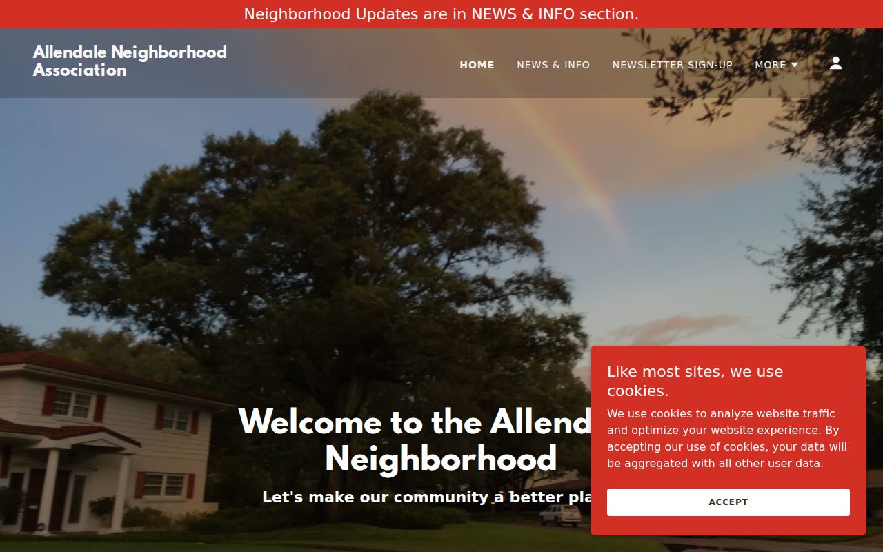
Use the public contact route for a civic question rather than reconstructing a group roster from newsletters or planning papers.
Allendale Township Development Evidence
Planning documents can be useful for an Allendale Township block when they name a master deed, legal development, phase, private road, or open space. Edgewater Farms material references a master deed and association of owners. Emerald Springs No. 2 material references an association, private roads, open space, and phases. Another reviewed subdivision packet says the covenants do not create an association or board. These examples show why a development name alone is not proof of a current organization.
When a map and planning packet point to the same subdivision, return to the parcel and Register of Deeds systems for a legal description or recorded instrument. Do not turn a planning application into a list of owners, residents, or members. Documents may be incomplete, dated, or controlled by a private association.
Note: A master deed describes a property structure and does not, by itself, establish who is present at an address.
Allendale Township Civic Links
Public civic information can add community context without becoming a people search. The Rotary Club of Allendale meets Wednesdays at noon at Peppino’s, 5065 Lake Michigan Drive, and uses PO Box 110. Public officers and meeting information can support local history or a community contact question. No public member directory was located, so club participation should not be inferred from a name or nearby address.
Township boards, commissions, DDA, and staff pages are another date-specific civic layer. They identify public service during a given period, not a person’s residence at a street. Preserve the meeting date, minutes, or source publication whenever an official role is relevant. GVSU archives and the historical society can supply older institutional context when a public record points to a campus or community event.
Allendale Township Source Comparison
Official records and commercial neighborhood tools do not serve the same purpose. Official sources identify their custodian, date, search field, and record limitations. Commercial tools may combine data from unclear dates or sources, which can create stale or mismatched results. The safer method is to use the official parcel or organization source, cite it, and leave an unresolved match unresolved.
| Source type | Strength | Limit |
|---|---|---|
| Official GIS and property records | Current public parcel and assessment context | Owner field is not a confirmed resident field |
| Planning and recorded development documents | Legal name, phase, or document context | Not a current association or household roster |
| Public community organization pages | Contact and civic context | Voluntary participation, no membership inference |
| Commercial neighborhood tools | May offer broad leads | Source date, accuracy, and lawful-use limits may be unclear |
Where a name needs individual verification, use the specific-record method in the Allendale Township resident lookup rather than a neighborhood list.
Allendale Township Election Privacy
Michigan voter registration records are public under FOIA, but public access excludes driver-license or state-ID numbers, month and day of birth, and phone numbers. Michigan does not register voters by party. The Michigan Voter Information Center and the local clerk are the official routes for a specific election question. They are not a tool for assembling a block list.
Address Confidentiality Program participants and other protected records need special care. A missing record, substituted address, or limited display is not a gap to overcome with parcel, voter, court, utility, or civic sources. Keep public records separate from protected information, and contact the agency when a public result conflicts with a confidentiality designation.
Allendale Township Neighbors Historical Context
Allendale’s historic record geography can change the meaning of an old block clue. Local history notes the Malta and Allandale name variants, the 1849 township organization, later boundary changes, and the 1961 selection of the GVSU campus site. Rural record coverage may sit under Ottawa County or a nearby city heading rather than an Allendale heading. A historic street entry must retain its source date and original place wording.
The township’s population snapshots also show the scale change behind modern and historical methods: 168 in 1850, about 1,100 in 1882, 20,708 in 2010, and 26,582 in 2020. These figures are context only. They do not identify the people on a present block or establish the completeness of any directory.
Allendale Township Neighbors Privacy Limits
Research around a block must have a lawful personal, family-history, or civic purpose. Do not use maps, records, or community contacts to stalk, harass, harm, or repeatedly contact someone. Never publish protected addresses, private phone numbers, confidential adoption information, sealed court details, or identity documents. An arrest, property owner field, civic role, or historical directory entry does not justify exposing a person’s private information.
Use a correction request rather than a public accusation if a property or address record seems wrong. State the source, record date, map date, and known limits. The most responsible Allendale Township neighbors result may be a narrow, documented finding that leaves household identity unresolved.